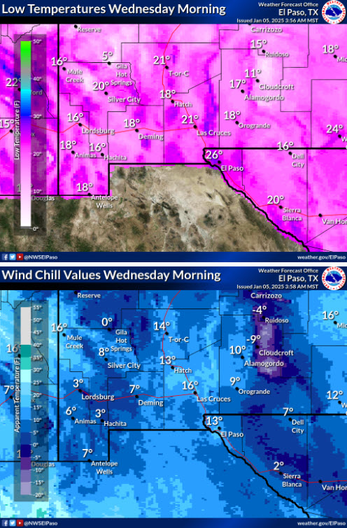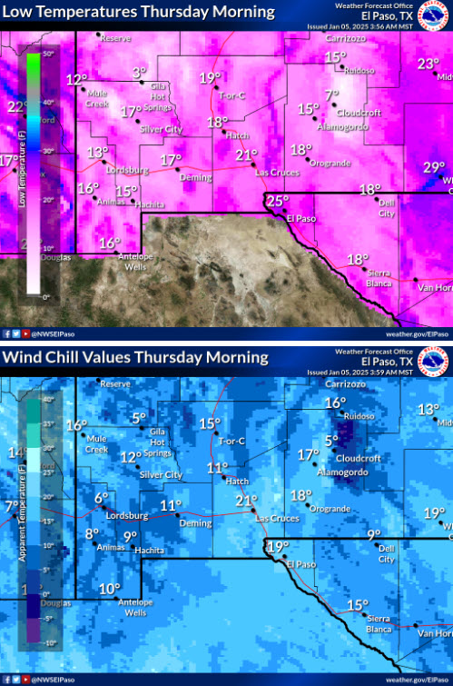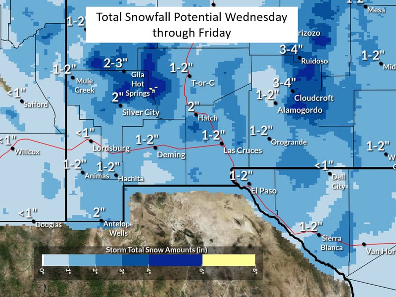
Here’s a broad overlook about what to expect across the Borderland with the upcoming storm system Tuesday night through Thursday and the threat level with each parameter. Model trends have been for less snow, but we are still expecting light snow off and on during this period. Some areas will only receive some flurries while other areas could see a few inches. The mountains, especially eastern slopes of the Sacramento Mountains will receive some modest accumulations. Snow amounts is where our confidence is lowest at this time.
We are confident temperatures will be falling Tuesday Night. We are also confident that east winds of 10-25 mph into Wednesday will create wind chills in the single digits and teens for the lowlands and below zero for the Sacramento Mountains. High temperatures Wednesday will struggle to get out of the lower to mid 30s for much of the region. Winds will decrease for Wednesday Night and Thursday but much below normal temperatures will remain.
The National Weather Service has forecasted wind chills in the single digits for the next few days.

We can also expect snowfall of up to 2 inches in the valley

Please check the 4 P’s: Plants, people pets and pipes.


